🗺️ The Map That Lied (and the War It Started)
Let’s get one thing straight: Ohio exists the way it does because somebody, somewhere, drew a very bad map. 🗺️
Like, comically bad.
We’re talking about a map so wrong it caused a border war, confused Congress, and basically turned Toledo into the punchline of one of America’s most gloriously petty feuds.
This is the story of how one misplaced lake launched the Midwest into a middle-school-group-project-gone-wrong-level situation. 😵💫

📍 The Line That Wasn’t a Line
Back in 1787, when Congress wrote up the Northwest Ordinance, they were trying to figure out how to chop up the wild frontier into future states. (Because if there’s one thing the U.S. government has always loved, it’s dividing a perfectly good wilderness into rectangles.)
Ohio’s northern boundary, they decided, would be “an east-west line drawn through the southerly bend or extreme of Lake Michigan, until it intersects Lake Erie.”
Sounds simple, right? Except - and this is the fun part - nobody actually knew where that was.
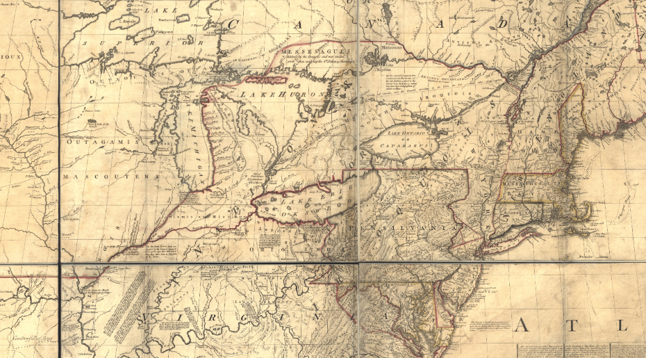
The only available map at the time was a British creation known as the Mitchell Map, drawn decades earlier. And it was... optimistic. According to the Mitchell Map, Lake Michigan sat several miles further north than it really does.
So, if you drew a line from that “southerly bend,” it would slice into Lake Erie above the Maumee River - meaning the city we now know as Toledo would end up in Ohio.
But when explorers later realized Lake Michigan was actually farther south, that line would have hit Lake Erie below the Maumee, putting Toledo in Michigan.
In other words: two governments, one Toledo.
Because of , essentially, a cartography typo. 🤓📍

Whoopsydaisy…
👉 If you want to see the full original Mitchell Map in all its wrong-and-proud glory, here’s a look: wikipedia.org/wiki/Mitchell_Map
🏗️ The Toledo Strip - a.k.a. 468 Square Miles of Chaos
This little slice of land - roughly 468 square miles along the Maumee River - became known as the Toledo Strip. And both Ohio and Michigan wanted it.
Why? Because in the early 1800s, the Maumee River was a huge deal for trade and transportation. It connected to Lake Erie, meaning whoever owned that strip could use connecting canals and become the shipping hub of the Great Lakes. 💪

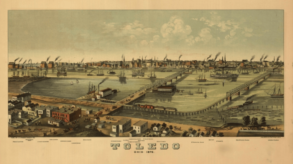
Toledo looked…a little different then.
So when Ohio wrote its first state constitution in 1802, it included the northern border as they believed it to be - i.e., the map version that put Toledo inside Ohio. And Congress allowed it. (Sort of. They didn’t exactly double-check.)
Meanwhile, Michigan - still a territory - used the more accurate later surveys to argue that, actually, the land was theirs. They even drew up maps and tax districts that included it.
What followed was less “duel at dawn” and more “middle managers arguing over whose spreadsheet is correct.” 🙃
⚔️ Enter: The Toledo War (Yes, That’s Its Real Name)
By the 1830s, the argument had gotten heated enough that both sides sent in the big guns - by which I mean surveyors and sheriffs.
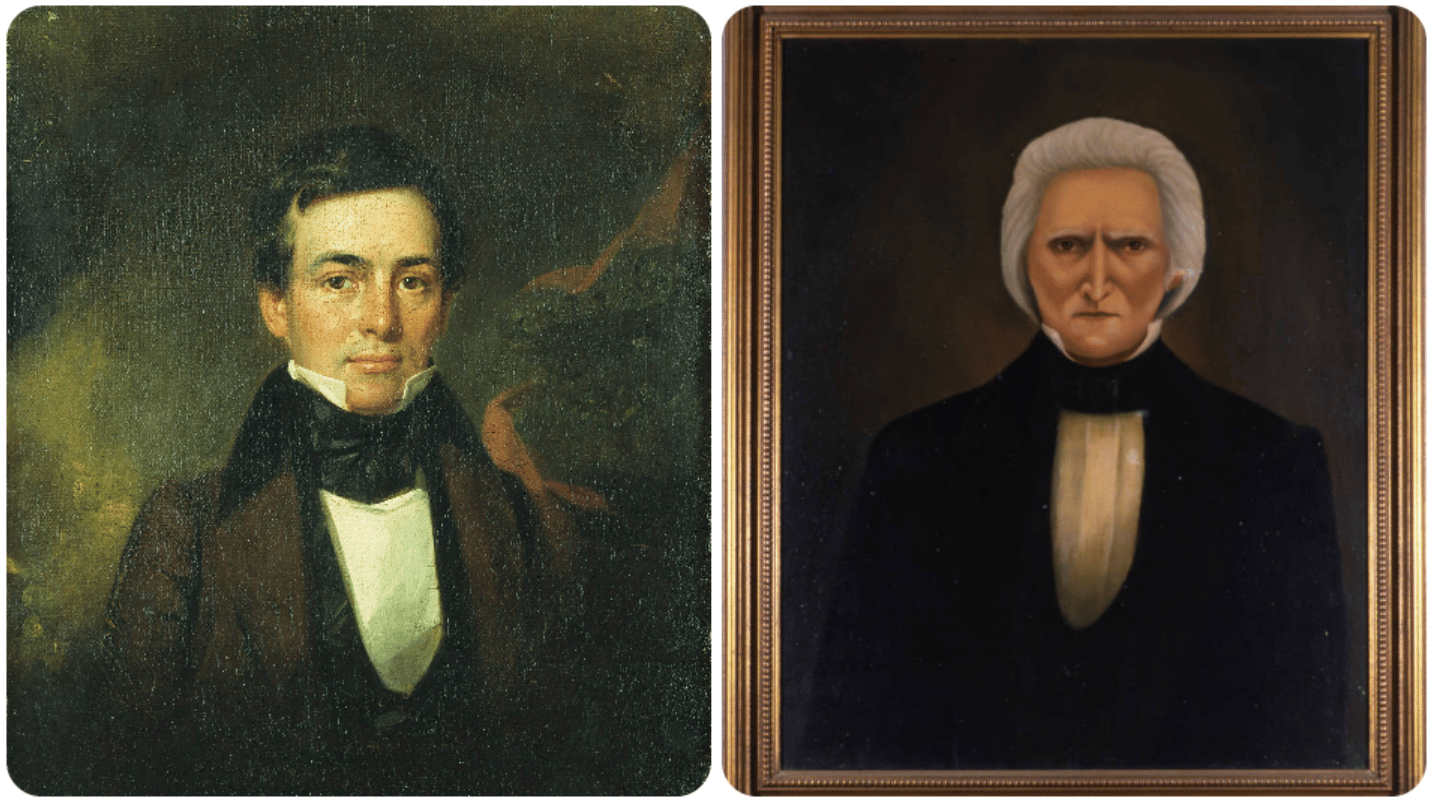
In 1835, Michigan’s territorial governor, Stevens T. Mason (nicknamed the “Boy Governor” because he was only 23), ordered armed militia units to patrol the disputed strip. Ohio’s governor, Robert Lucas, did the same.

‘Hey Robert, wanna play chicken?’ (Spoiler alert, he said ‘heck yeah.’)
Both sides passed laws claiming jurisdiction. Both sides arrested each other’s officials. And both sides refused to back down.
At one point, Michigan’s sheriff Joseph Wood was stabbed with a penknife by an Ohioan named Two Stickney (yes, that’s actually his name) - the only recorded injury of the so-called war. Ohioans insisted the attack was self-defense. Michiganders called it an “outrage.”
👉 For a delightful primary source on that incident, check out the Ohio Memory archives: ohiomemory.ohiohistory.org/archives
Eventually, Michigan militia captured a few of Ohio’s surveyors, and marched on the territory. But it was too late, because Ohio had already held a super secret “sunrise court session” in Toledo - literally convening before dawn just to officially say “we’re totally in charge here” before the Michigan fuzz could stop them…and skedaddling before anybody got there. 😅
I know it’s silly but as an Ohioan, I can’t help but feel a little proud that they outsmarted the Wolverines. The pettiness is almost inspiring. 😏
The whole standoff was dubbed the Toledo War, though no one actually died. (That would be a very different article.) Just a lot of yelling, paperwork, and perhaps the most passive-aggressive state rivalry ever recorded.
👉 For a readable overview, History.com’s article nails it: history.com/articles/the-toledo-war
🧭 Congress Steps In (Eventually)
By 1836, the situation had become too embarrassing and annoying for Washington to ignore. Andrew Jackson finally stepped in and eventually a compromise was brokered:
Ohio got to keep the Toledo Strip (and the right to smugly point to it on maps forever).
Michigan, in exchange, was granted most of the Upper Peninsula, which at the time everyone thought was worthless.
That deal became official when Michigan agreed to it as a condition to their statehood - though they grumbled for years.
Ironically, that “worthless” land turned out to be full of iron ore, copper, and timber - so Michigan arguably came out ahead.
Imagine being so mad about losing Toledo that you accidentally gain the U.P.
👉 Here’s a great summary from the Michigan Tech historical archives: mtu.edu/mhugl
🏴☠️ What It Says About Ohio (and Us)
There’s something so deeply Midwestern about this story.
We didn’t win the war through violence. We won it through stubbornness, hustle, and better PR. 😂🙈
Ohio lobbied harder, had more political allies, and generally out-bureaucrat’ed Michigan.
And isn’t that kind of the most Midwestern thing ever - fighting a war with paperwork, while threatening knife fights, and still being polite about it?
The whole saga also explains a lot about why Ohio borders look so weird. We’re not a neat rectangle like Colorado or Wyoming. We’re a squiggly, slightly asymmetrical state held together by rivers, old surveys, and vibes. ✌️
And that’s part of our charm.
If you zoom in on a map of northern Ohio today, you can still see the faint zigzag where that line was finally drawn - a ghost of the original cartographic mess that started it all.
🌅 A Nerdy Moral to the Story
Every map is a story about what people thought they knew.
In this case, one wrong assumption literally redrew the Midwest.
Without that mistaken line, Toledo might be part of Michigan, Michigan might be missing its Upper Peninsula, and the term “Rust Belt” might look totally different. 🤯
So next time your GPS takes you on a weird detour, remember: it could be worse. It could have started a war. 🙆♀️

📺 Want a chuckle? 😅
👇Check out these CLE commercials from the early ‘90s 👇
I especially loved the super weird camera work in the Almay commercial, the Army of Darkness appearance, the Seth Green cameo, and the little baby Christina Applegate trailer. 😂 #nostalgic

P.S. — This list of stuff to do in NEO during Spooky Season is so good! You have to see it…it has a ton of ideas that are kid and family friendly, plus Halloween events & more. Get these events on your calendar now! 🎃

Interested in reaching our Cleveland audience? We have tons of opportunities to get eyeballs on your biz. Click here to learn more | Click here to book a call with us


